Categories
- /Barking and Dagenham
- /Barnet
- /Bexley
- /Bromley
- /Cam-Hampstead
- /Cam-Holborn
- /Cam-St Pancras
- /City of London
- /City-Aldgate
- /City-Billingsgate
- /City-Bishopsgate
- /City-Broad Street
- /City-Castle Baynard
- /City-Cornhill
- /City-Cripplegate
- /City-Fleet Street
- /City-Queenhithe
- /City-Smithfield
- /City-Tower
- /City-Vintry
- /City-Walbrook
- /Croydon
- /Gre-Greenwich
- /Gre-Woolwich
- /Hac-Hackney
- /Hac-Shoreditch
- /Hac-Stoke Newington
- /Ham-Fulham
- /Ham-Hammersmith
- /Isl-Finsbury
- /Isl-Islington
- /Ken-Chelsea
- /Ken-Kensington
- /Lam-Clapham
- /Lam-Lambeth
- /Lam-Streatham
- /Lew-Deptford
- /Lew-Lewisham
- /Merton
- /Newham
- /Sou-Bermondsey
- /Sou-Camberwell
- /Sou-Southwark
- /Sutton
- /Tow-Bethnal Green
- /Tow-Poplar
- /Tow-Stepney
- /Wan-Battersea
- /Wan-Wandsworth
- /Wes-City of
- /Wes-Paddington
- /Wes-Piccadilly
- /Wes-St James
- /Wes-St Marylebone
- /Wes-Strand
- /Wes-Westminster (Area)
- /Wes-Whitehall
- COMMON ITEMS
- PERSONS
- SUBJECTS
- Subj_Background Page
- Subj_Baird, John
- Subj_Borough High Street and Its Inns
- Subj_Bridges Crossing the Thames
- Subj_Canals
- Subj_Cemeteries
- Subj_Chaucer, Geoffrey
- Subj_Cheapside
- Subj_Christmas
- Subj_Churchyards
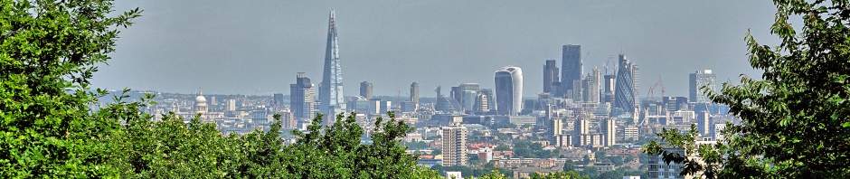
- Subj_City Views
- Subj_Coaching Days
- Subj_Coaching Inns
- Subj_Coaching Mailcoaches
- Subj_Comment
- Subj_Crossrail (Elizabeth Line)
- Subj_Croydon Canal
- Subj_Grand Surrey Canal
- Subj_Great North Wood
- Subj_Greenwich Wharves in the 1960s
- Subj_Hospitals
- Subj_Ice and Ice Wells
- Subj_Inns of Bishops etc
- Subj_Inns of Chancery
- Subj_Inns of Court
- Subj_Jews in London
- Subj_London and Greenwich Railway
- Subj_London Bridge
- Subj_London in 1891
- Subj_Long Views
- Subj_Manors
- Subj_Maps of London
- Subj_Markets
- Subj_Met London History
- Subj_Metropolitan London
- Subj_Milestones
- Subj_Mini-Lectures
- Subj_Modern Buildings
- Subj_Moment in Time
- Subj_Museums
- Subj_Overviews
- Subj_Parish Markers
- Subj_Pictures
- Subj_Prisons
- Subj_Property Marks
- Subj_Quick Look Around
- Subj_Railways
- Subj_Regent's Canal
- Subj_Reminiscing
- Subj_Roman Roads
- Subj_Roman Wall
- Subj_Saxons in London
- Subj_Squares
- Subj_Temple, The
- Subj_Thames
- Subj_Thames Sailing Barges
- Subj_Toilet Buildings
- Subj_Travels Outside London
- Subj_Upper Thames Street
- Subj_Victoria Embankment
- Subj_Vikings in London
- Subj_Wren, Christopher
- Uncategorized
Tags
Monthly Archives: Feb 2021
Belgravia – Quick Look Around
Above: One of many grand houses in Belgravia, this one stands in Wilton Terrace. The name of Belgravia was invented for land in the City of Westminster, deriving from Belgrave, on the northern outskirts of Leicester, once a small village … Continue reading
Dolphin Square
Above: View looking west at the 10-storey front which overlooks the Thames beside Grosvenor Road. It may be a good idea to start by explaining that the name Dolphin Square is not the name for a London square – like … Continue reading
Posted in /Wes-Westminster (Area)
2 Comments
Huskisson, William (Memorial)
Above: Statue of William Huskisson in Pimlico Gardens. William Huskisson (11 March 1770 – 15 September 1830), British statesman, financier and Member of Parliament for several constituencies, including Liverpool. He became a distinguished MP who led a busy life. He … Continue reading
Posted in /Wes-Westminster (Area), PERSONS, Subj_Railways
Leave a comment
Neat Houses
Above: John Rocque’s small scale map of 1746 showing part of what is now Pimlico. John Rocque’s two maps – the large scale version and the small scale one – both published in 1746 contain an enormous amount of detail … Continue reading
Posted in /Wes-Westminster (Area)
2 Comments
Pimlico – Quick Look Around
Above: Houses in Lupus Street. There are many streets in the district with houses that all look very similar. Pimlico is a district in Westminster lying beside the Thames with an approximate boundary to the east of Vauxhall Bridge Road … Continue reading
Millbank (Street)
Above: Modern view of Millbank across the Thames. The road runs near the modern embankment. Millbank Tower is in the centre of the view. Part of Vauxhall Bridge can be seen on the far left and the modern Tate Britain … Continue reading
Posted in /Wes-Westminster (Area)
7 Comments
St John, Smith Square
Above: Two of the four towers on top of the church. Development of Westminster to the south of where Westminster Abbey and the Houses of Parliament stand was relatively slow. This was because that land was very marshy and subject … Continue reading
Posted in /Wes-Westminster (Area)
Leave a comment
Westminster after the Dissolution
Above: Part of the so-called Agas map, produced about 1561. Westminster at the Time of the Map The above map shows Westminster in about 1561. It was published at an interesting time. For any local people who were older than … Continue reading
Posted in /Wes-Westminster (Area)
Leave a comment
Westminster, Palace of
Above: The Palace of Westminster (Houses of Parliament) seen from across the Thames. Before we continue any further, it might be helpful to state that the site of the Palace of Westminster is today where the Houses of Parliament are … Continue reading
Posted in /Wes-Westminster (Area)
Leave a comment
Westminster, Manor of
Above: Outline map of the Manor of Westminster in medieval times. In AD 959 the Saxon King Edgar defined the boundary of the Manor of Westminster as mid-stream in the Thames to the south; following the course of the Westbourne … Continue reading
